File:Map of L5.png
From FenWiki

Size of this preview: 800 × 577 pixels. Other resolution: 320 × 231 pixels.
Original file (1,107 × 799 pixels, file size: 63 KB, MIME type: image/png)
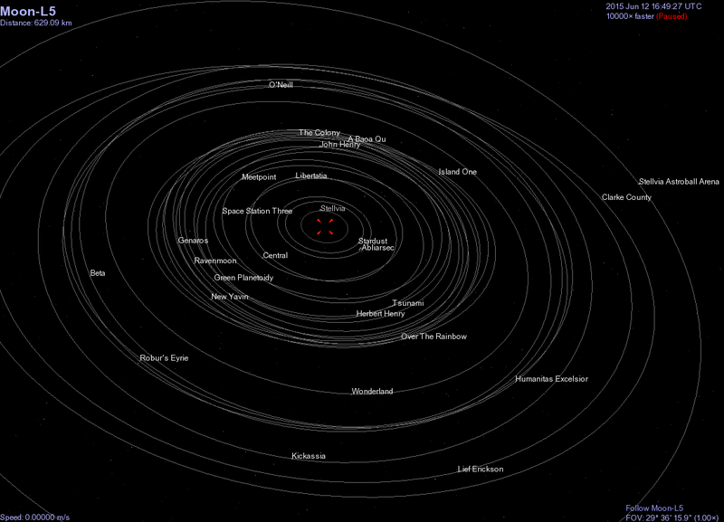
The locations and orbital paths of each station and habitat in the Earth-Luna L5 cluster. Built and imaged in Celestia.
File history
Click on a date/time to view the file as it appeared at that time.
| Date/Time | Thumbnail | Dimensions | User | Comment | |
|---|---|---|---|---|---|
| current | 03:55, 31 October 2010 | | 1,107 × 799 (63 KB) | Mal-3 (Talk | contribs) | Updated locations of stations based on more correct calculations of orbit times around the lagrange point. |
| 19:33, 10 October 2010 | 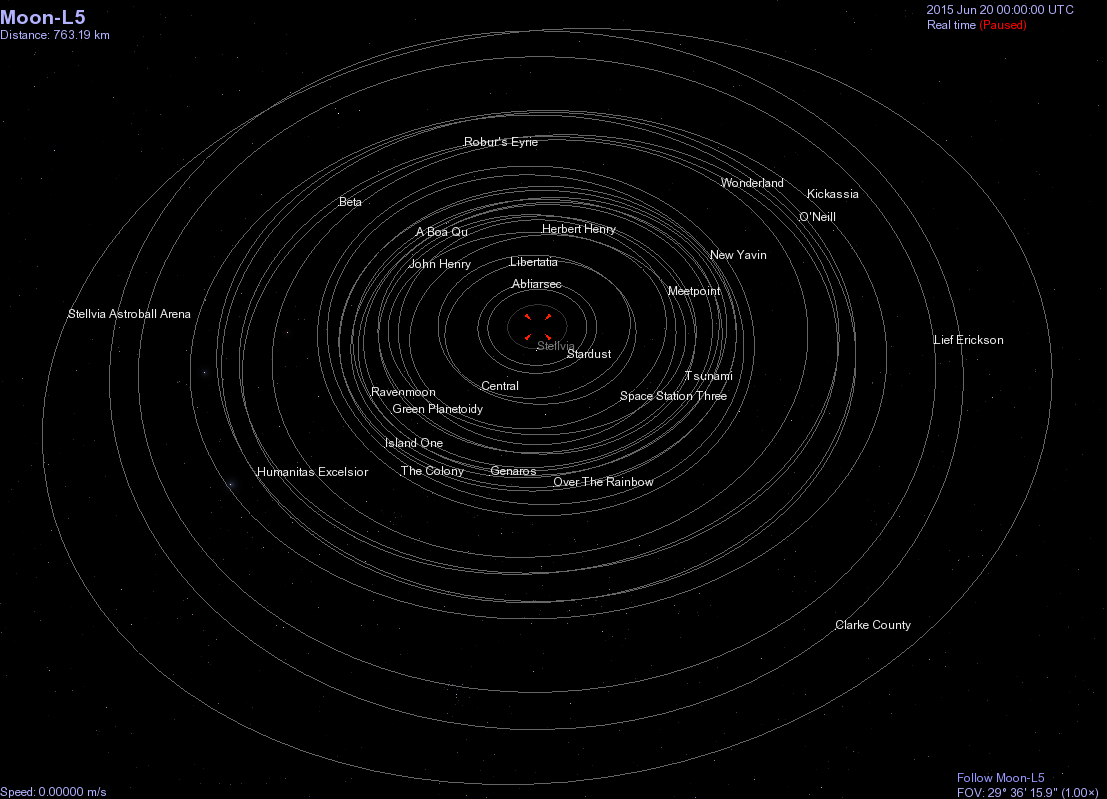 | 1,107 × 799 (66 KB) | Mal-3 (Talk | contribs) | The locations and orbital paths of each station and habitat in the Earth-Luna L5 cluster. Built and imaged in Celestia. Category:Art by Sean Breen Category:Places in Fenspace Category:Earth-Luna L5 |
- You cannot overwrite this file.
File usage
The following page links to this file: